20 km of embankment
Da Nang City (Vietnam)
2016
Development of the Han River banks over 20 km to ensure harmonious city growth in a mild and pleasant climate
Client
People Committee of Da Nang City
Design team
DE-SO / PHYTOLAB landscapers
Construction cost
N.C.
Mission
Competition third prize
Cities grow, the geography remains.
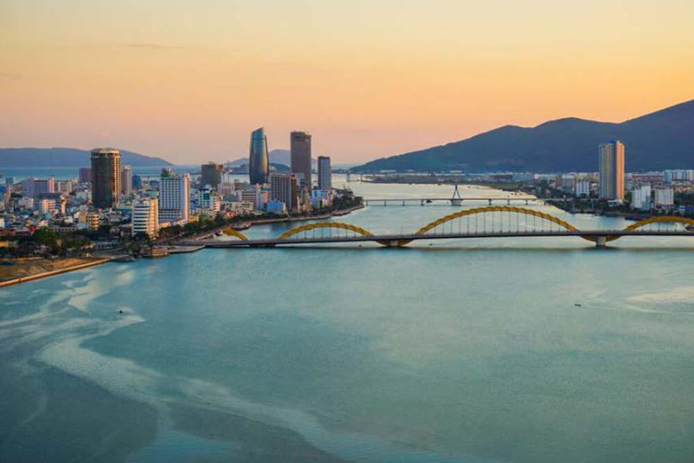
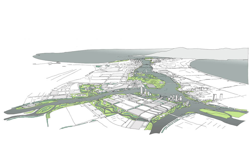
Many cities have naturally been built on the banks of rivers. Da Nang is also located on an estuary.
The relationship between the urban, geometrical design and the supple and sinuous geography of rivers gives cities a specific identity.
In Da Nang, the design and layout of the colonial period port should resist major changes in use and urban development, real estate development pressures, and the development of communication and transport networks.
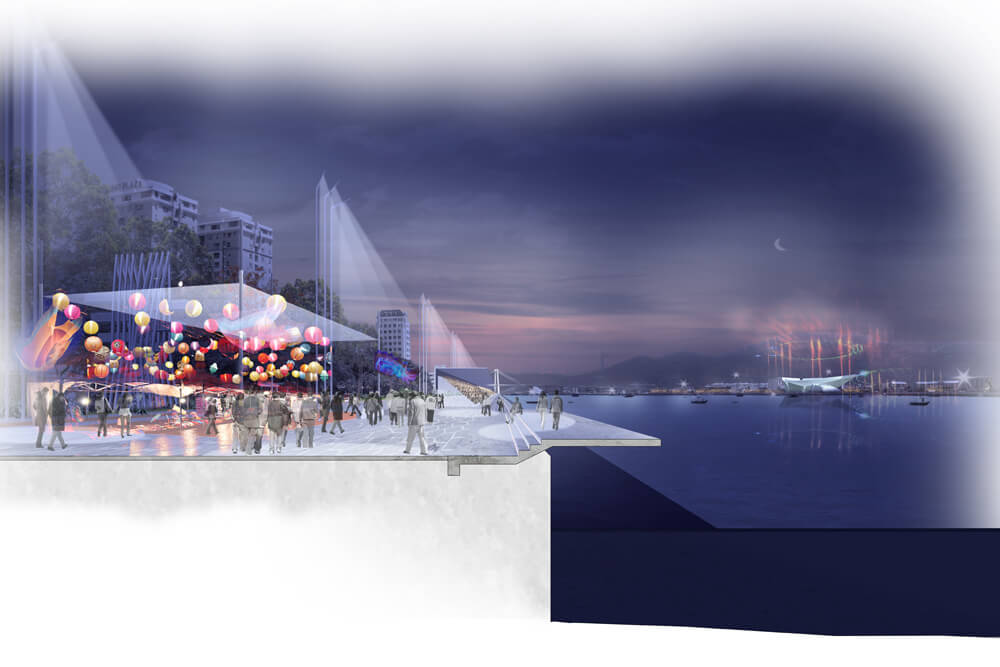
The old commercial edges of the quays, along the banks of the Han River, are now doubled by a new contemporary and tourist shoreline, along the eastern seaboard coastline. These banks in parallel give the city a specific identity and a multitude of perspectives.
In each location, specific geography creates specific characteristics, the urban postcard. Some cities relate to their beautiful rivers, not others…
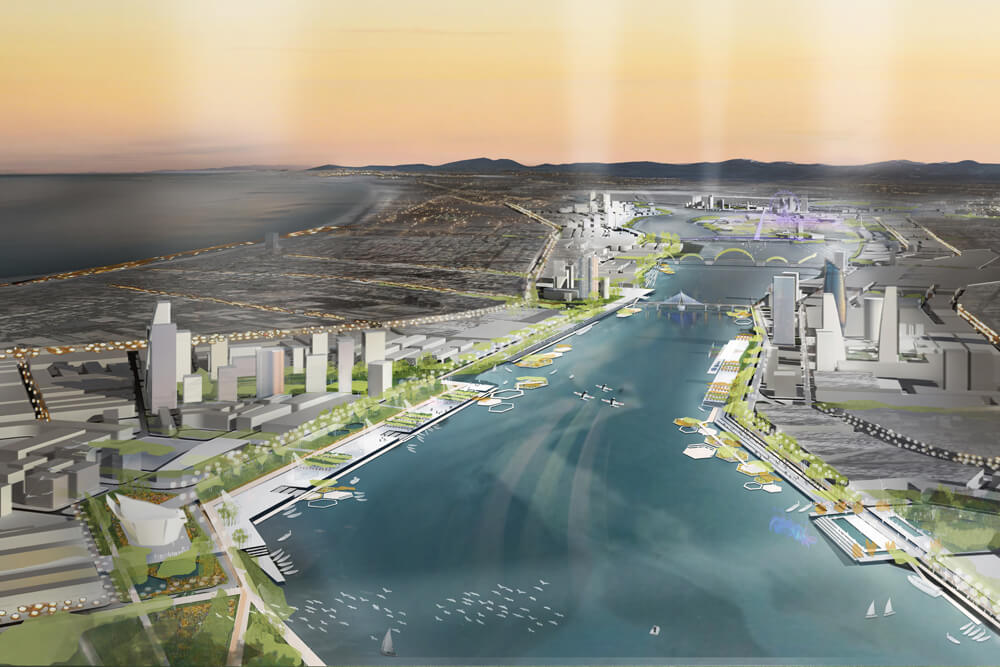
A proposed heritage project, the Han River waterfront development should become one of the most powerful symbols for the 21st century city.
It provides new areas for urban development, restores an exceptional and emblematic landscape; a landscape and urban design that promotes an intuitive understanding of the region, creating living places for encounters.
An attractive showcase of the city that reflects its energy, an alternative simple and ecological approach, a counter-proposal to the “Smart City” concept that promotes special elitist aspects of the city yet forgets its relationship to geography, the source of all identities.
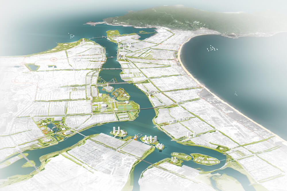
The districts developing along the Han River should accommodate contemporary areas that are symbolic and emblematic of an engagement for conservation and the defense of environmental quality.
In the second half of the 20th century, the port function and its surroundings in many large cities have successively given way to major communication routes that abruptly cut off residents from their river. This can be avoided in Da Nang if land use and urban developments along riverside areas anticipate these abrupt breaks of the city from nature.
On the edge of the city, the design intent respects the existing, its heritage – economic and ecological. It intends to compose with existing land use and the residents, to integrate into the rich history of the city with its river and to influence the link between residents with nature; their use of open spaces, their wishes.
The intention is to densify the central transition zones, between the historic city center and the coastal city with the river in the center, to set up an urban and landscape proposal that implements three themes:
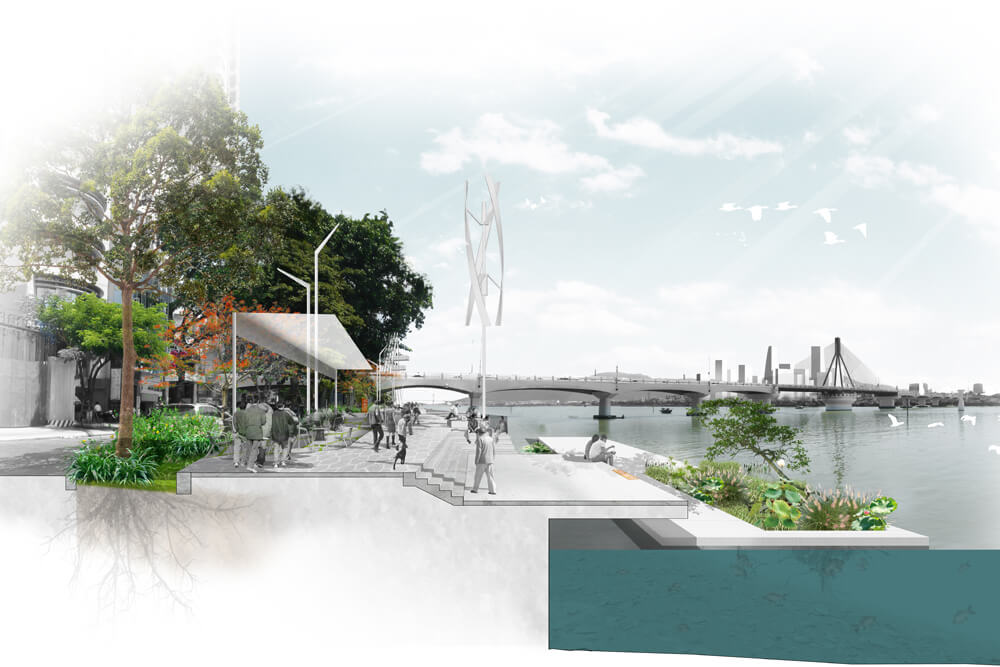
– The first is to elaborate a project that bears the identity and the uniqueness of the location, its history, its geography that gives attention to culture, to art and land use confronted by the development of an indiscriminate and homogeneous architecture; to make Da Nang a beautiful and unique city – a city with lively public riverbanks that each resident appropriates…
– The second is to work in harmony with nature, the climate and geography by “inviting” rainwater and gray waters from all the neighborhoods bordering the Han River onto shared spaces along the riverbanks to dilute and treat them; to develop porous and planted ground to vegetate the banks.
– The third is to bring shade into the city.
From the heavily planted riverbanks, a series of green fingers (shade tree alignments) connects the river to the city. They bring into the tropical environment, within the typhoon zone, the resources and the tools necessary to permanently establish trees in Da Nang …
Proposed in sectors, projects focus on the need for a more cohesive and sustainable city with an enhanced green and blue grid, through the dynamics of diversified land use, reclaimed land …
The attractiveness of Da Nang City is at stake in the seduction competition taking place between the major Vietnamese cities.
The positive force and generator of wealth wherein Da Nang can be drawn, will be to combine a strong architecture sensitive to land use and respectful urban planning interwoven between nature, the economy and available resources.
The objective is to build with foresight important city landscapes, to reinforce the postcard that enhances the river.
For an ecological and sustainable approach to the city, we propose tools that preserve the natural attributes of the riverbanks; to develop within the city the infiltration and densification of nature that stems from the river.
While shade and water have coexisted for centuries, the urban development has now become obvious.
The objective is to ensure harmonious city growth in a mild and pleasant climate, to soak up potential river flooding, to take into account climate change and the inevitable land salinization that results from rising sea levels and strong tides.
Ecological and responsible in the eyes of the world, the future city can no longer be systematically developed. It should host contemporary spaces that are symbolic and emblematic of the power attached to the conservation and defense of the environmental quality in the very heart of city centers.
The different quay sectors are separate ecotones, transition zones between two ecosystems where the border and boundary areas between different environments develop, rich in biodiversity. The project proposes many actions that enhance (like fractals) the interface between land and water.